|
|
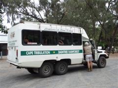
Bob Berrill & the tour 4WD,
Mowbray St, Port Douglas
Image © David Powell, 2007
|
Day 5
Today we went on a 4WD safari to Port Douglas, Mossman, the Daintree
and Cape Tribulation. Wanted a tour that did all those locations and
only took a small number (didn't want to end up in a big bus) .. we
settled on Trek North, tho' there were several that offered similar
packages. The trip to Cape Tribulation is a bit rough and not exactly
the sort of terrain one wants to take a hire car. Besides, with a tour
guide you get a lot of background information and access to things that
the general public might not know about. The Daintree is touted as the
world's oldest rainforest.
Palm Cove was actually the first stop on the tour - most were picked up
in Cairns. The area around Palm Cove was charted by Captain Cook, who
named the islands offshore .. Double Island because it, well, has two
hills, and Haycock Island, named after his cabin boy. I guess he wasn't
feeling exactly inspired in the naming department that day. The tour
guide, Rob Berrill, certainly knew his stuff, but then he only
moonlights with these sorts of tours .. he normally runs off road
expeditions to the most isolated and inhospitable parts of the country.
Back to Palm Cove .. a few metres in from the beach are a lot of tall
and rather beautiful white gum trees. Quite old too - Captain Cook
noted them in his log. The local building code insists the trees be
left intact, so the resorts and restaurants are built around them,
sometimes incorporating the trees into their structures - one resort
has a tree growing thru' the lobby and out thru' the roof.
Just south of Wangetti was the site of an old half-way station built in
the 1800's for bullock carts traveling between Cairns and Port Douglas.
All that's left now is a stand of mango trees .. the site itself is
used by the government to store road base. Hartley Crocodile farm is
actually the second of that name. The original, now abandoned, is next
door to the present one which we visited yesterday, and dates back to
the 1930's.
|
|
|
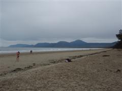
Four Mile Beach, Port Douglas
Image © David Powell, 2007
|
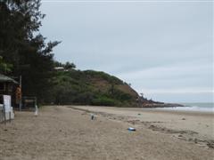
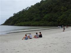
Pebbly Beach .. the names says it all. At low tide sandbanks are
exposed stretching 100's metres out from the shore. According to local
legend the beach is cursed ... anyone taking home a pebble will suffer
bad luck. Hmmm... not exactly a unique story, I've heard that claim
before elsewhere. Eagles are reasonably common in the area and for some
reason they have taken to making their nests on the top of telegraph
poles rather than the 'traditional' trees. Plenty of trees around, but
I guess the poles make the nests safer from predators .. it's easier to
climb a tree after all.
|
|
Four Mile Beach, Port Douglas
Image © David Powell, 2007
|
Port Douglas. Originally a fishing village. In the late 1800's a nearby
gold find saw the town boom with 27 hotels and a population of 12,000.
But the gold soon ran out and the town went back to being a sleepy
fishing village. A cyclone in 1911 demolished all but two buildings in
the town also had a significant impact. By 1960 the population had
dropped to just 100. In the 1970's a new form of gold was discovered,
the tourist dollar. In a big way. Disgraced businessman Christopher
Skase picked Port Douglas as the site for his high-class tourist mecca,
turning the fishing village into a resort town. Skase eventually fled
the country, leaving behind countless creditors and huge tax bill to
spend his last few years in exile in Spain, fighting off the lawyers.
While in the rest of the country Skase is seen as a villain, in the
Port Douglas/Cairns area he's seen as a hero - his vision of turning
Port Douglas into the Rivera of the Coral Sea was taken up by others
and eventually spreading to other towns in the region such Palm Cove,
even Cairns itself. And a tourist success the region definitely is. It
seems there're more foreign tourists in the area than Aussies,
especially Japanese and Germans and back here in Sydney it seems every
second person has been to Cairns. Perhaps an exaggeration .. but not
much of one. Housing prices have soared as well - the record price for
a house was set early 2007 .. a whopping $A14.2 million. Still, despite
that they have stuck pretty well to the local building code - no
building to be taller than a palm tree, no traffic lights and no fast
food joints. Mind you, Cairns also had the palm tree guide in their
building code .. I think they must've started feeding their palm trees
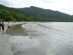
steroids or something! The south side of the Port Douglas peninsula is
one big beach. It was originally the road access to the town and even,
for a time, used as an airstrip.
|
|
|
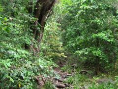
Rainforest, Mossman Gorge
Image © David Powell, 2007
|
|
|
|
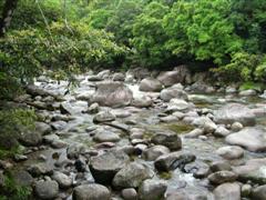
Mossman River, Mossman Gorge
Image © David Powell, 2007
|
|
|
|
Mossman River, Mossman Gorge
Image © David Powell, 2007
|
|
|
|
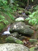
Small stream, Mossman Gorge
Image © David Powell, 2007
|
|
|
|
Mossman River, Mossman Gorge
Image © David Powell, 2007
|
|
|
|
Mossman River, Mossman Gorge
Image © David Powell, 2007
|
|
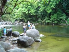
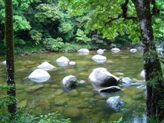
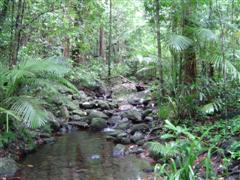
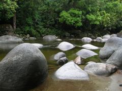
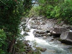
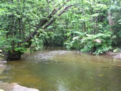
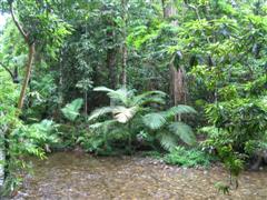
North to Mossman, passing thru' the town and onto the Daintree National
Park. The Mossman Gorge, part of the Daintree National Park, is a
closed canopy rainforest - that means the canopy is so thick that not
much light gets thru' to the ground below so there's not that much
ground level vegetation ... mostly mosses and ferns .. hence the name
of the place, I presume. The gorge is, in a word, beautiful. The 45
minute tour we went on did not really do it justice. Alas, that's all
the time we had. Saw the gorge from several vantage points .. a
middling sized stream, full of large boulders and a nice waterfall.
Beautiful. Peaceful. Tranquil. Then there's the rainforest. Very green,
very lush and very wet - the was an inch of rain the previous evening
and everything was wet and glistening like, well, one would expect a
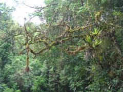
tropical rainforest would look. Tall trees, lots of epiphyte plants ..
orchids, ferns, bromeliads and so forth, often covering the trees, as
well as parasitic plants such as Strangler Figs. Lots of creepers -
Tarzan would have had a ball. One interesting parasite was the Lawyer
Palm (Calamus mulleri), a palm tree that behaves more like the
Strangler Fig. It can only grow to 1-2 metres on its own, but it sends
out creepers with hooks which hook onto other plants so that it can
grow beyond its normal height, often eventually killing the host. I'll
refrain from lawyer jokes - I have a few friends in the legal
profession who'll likely read this. Then there's the Strangler Fig,
which behaves just as the name suggests. It grows around its host,
eventually strangling it to death.
The Daintree is described at the oldest rainforest in the world, having
survived over 200 million years of world climate changes and is
something of an evolutionary backwater, with many plants and animals
little changed since before the last ice age, providing a snapshot of
the beginnings of flowering plants. To give you an idea of the age of
the Daintree - dinosaurs first appeared 230 million years ago. The
Daintree is also the most ecological rich ecosystems on the Australian
continent and one of the richest anywhere in the world. It is home to
the largest range of plants and animals on earth, and all are found
within the largest chunk of rainforest in Australia - an area spanning
approximately 1200 square kilometres, the second largest tract of
virgin rainforest in the World next to the Amazon. It well deserves its
World Heritage Listing. Locals strongly opposed the Heritage listing,
with fears of the devastation it would have on the local community with
the end of logging .. but today tourism brings in more than logging
ever did, with over 400,000 visitors every year. The Daintree is also
the only place in the world where two World Heritage Sites exist
side-by-side, the Daintree and the Great Barrier Reef. Or as the local
slogan goes, "where the rainforest meets the reef."
|
|
|
|
|
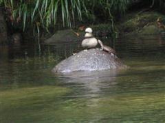
Curious tortoise, Mossman River
Image © David Powell, 2007 |
Mossman River, Mossman Gorge
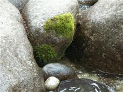
Image © David Powell, 2007 | Mossy rock, Mossman River
Image © David Powell, 2007 |
|
|
|
|
Mossman River, Mossman Gorge
Image © David Powell, 2007 |
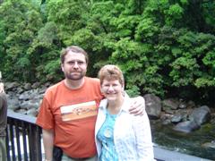
David & Cynthia, Mossman Gorge
Image © David Powell, 2007 | Rainforest, Mossman Gorge
Image © David Powell, 2007 |
|
|
|
|
|
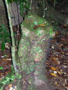
Mossy stump,
Mossman Gorge
Image © David Powell, 2007 |
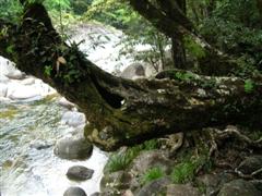
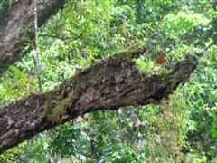
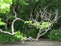
Mossy branch, Mossman Gorge
(could this be an Ent's hand?)
Image © David Powell, 2007 | Small stream,
Mossman Gorge
Image © David Powell, 2007 |
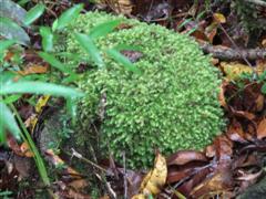
Moss (naturally), Mossman Gorge
Image © David Powell, 2007 |
|
|
|
Start of Daintree River Cruise
Image © David Powell, 2007
|
|
|
|
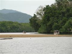
Sandflat & tour boats,
Daintree River Cruise
Image © David Powell, 2007
|
|
|
|
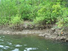
Mangroves & crocodile run,
Daintree River Cruise
Image © David Powell, 2007
|
|
|
|
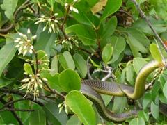
Snake, Daintree River Cruise
Image © David Powell, 2007
|
|
Back thru' the town of Mossman and on north to the next destination.
Mossman itself is a sugar cane town, founded in 1876. Originally a gold
rush town, Mossman soon turned to sugar with the first plantation
established in 1896 and the first sugar refinery the following year.
Today the refinery is the heart and soul of the town. A few nice old
buildings, but for everyone other than the sugar industry it's just a
small, nondescript town, between A and B. In the "funny signs" category
there's a petrol station with the name "Tummy & Tank" .. ok, maybe
more the groan sort of funny than the truly humourous. One last note on
Mossman .. the White Cockatoo Cabins, a caravan park, is home annually
to a nudist convention. The village of Miallo is nearby. Not much of
note, tho' just out of town is Karnak, home of Diane Cilento, Sean
Connery's first wife. Yup, the former Mrs James Bond. More importantly,
Miallo is the turn off for the road to Daintree ... the town, not the
national park. Miallo is also home (at the moment) to Tom Cruise's
latest film venture, a flick set in the Coral Sea.
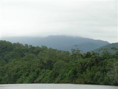
Visible almost anywhere in the Daintree region is Thornton Peak, the
third highest mountain in Queensland at around 1370 metres. Not high
enuf for snow, but it certainly gets the rain ... some 7-12 metres a
year and the top of the mountain is hidden in cloud for more than 320
days a year. The rain that falls on Thornton Peak is crucial to the
year-round lushness and vitality of the Daintree region.
We didn't actually get to Daintree, the town. Just out of town we
stopped at the Daintree River Cruise Centre and then cruised down the
Daintree River for about an hour. There're at least a dozen companies
running cruises on the river. Some just cruise up the river while
others get close and personal with the wildlife and the shoreline. We
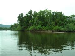
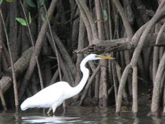
saw a variety of animals .. crocodiles, snakes, birds, fish and crabs.
Some tid bits from the guide's spiel ... there're 30 different types of
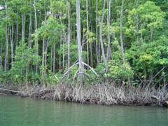
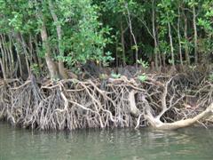
rainforest in the Daintree National Park. Mangroves have air roots
which grow upwards and allow the plant to "breathe" even at high tide.
The Daintree is the only national park in the country that stretches
from the coast up to the mountains - so has a complete mountain to
coast ecology - there're no main roads or stretches of "civilisation"
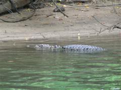
breaking up the park. We saw "Fat Albert", the resident male salty
crocodile in the Daintree River. The boat got within a few metres of
him ... the tour boats are so common on the river that much of the
wildlife now considers them to be part of the scenery, especially since
they have nothing to fear from the boats or the tourists. Fat Albert's a
giant .. he arrived during the 1990's and drove out the then resident
male ... who was last seen swimming away in the ocean, looking for a
new home. Fat Albert's one of the largest salties known in the wild. Lots
of different types of plants and ecosystems in the park ranging from
tropical rainforests upstream to mangrove swamps near the mouth of the
river. The wildlife aside, the views on the cruise are amazing.
|
|
|
|
|
Thornton Peak, Daintree River Cruise
Image © David Powell, 2007 |
Island, Daintree River Cruise
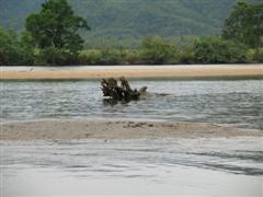
Image © David Powell, 2007 | Stump & sandbar, Daintree River Cruise
Image © David Powell, 2007 |
|
|
|
|
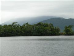
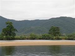
Sandbar & mountains, Daintree River Cruise
Image © David Powell, 2007 |
"Fat Albert", Daintree River Cruise
Image © David Powell, 2007 | Bird & mangroves, Daintree River Cruise
Image © David Powell, 2007 |
|
|
|
|
Salt water mangroves, Daintree River Cruise
Image © David Powell, 2007 |
Salt water mangroves, Daintree River Cruise
Image © David Powell, 2007 | Ferry, Daintree River Crossing
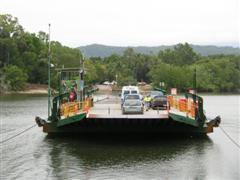
Image © David Powell, 2007 |
|
|
|
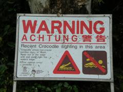
Warning sign, Daintree River
Ferry Crossing
Image © David Powell, 2007
|
|
|
Stick insects,
Daintree Entomological Museum
Image © David Powell, 2007
|
The cruise ended at the Daintree Ferry which controls the only
vehicular access from south of the Daintree River to the bulk of the
park which is to the north. Back on the 4WD for a drive thru' the
Daintree. Dark, lush and green. Ferns, creepers, tall trees, palm
trees, small rivulets everywhere ... yup, it's definitely a tropical
rainforest! Three quarters of Australia's fern species can be found in
the Daintree. For better or worse, the area north of the Daintree River
is not all national park .. there's some farms and pockets of
civilisation. There're several tea plantations, coffee plantations and
tropical fruit plantations. One of the latter also makes ice cream, but
more on that later. We stopped at the Daintree Entomological Museum
where we had lunch in the rainforest .. well a sheltered BBQ area on
the museum's property with rainforest on two sides, a bubbling brook on
a third and over an embankment ... the car park on the 4th side. There
was quite a noticeable temperature difference from Mossman or even the
river cruise. There it was coolish, even if very humid. At the "Bug
House", as the museum is locally known, the temperature was a good 5-10
degrees warmer .. and just as humid. Lots of cloud so plenty of good
shots of the mountains with their tops hidden in the clouds. Walked
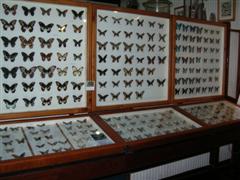
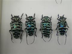
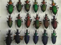
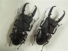
thru' the museum - it's a sizable collection of bugs collected locally
and from around the world. It's amazing how many specimens can be
squeezed into a not-too-big building .. but then, insects are not all
that big. They also run breeding programmes there, breeding stick
insects, butterflies and various exotic cockroaches. They had several
glass tanks with giant roaches ... some up to 5 inches long. Hmm... I'd
hate to meet one of those in the middle of the night at home. Not that
they're dangerous .. just the scare factor.
|
|
|
|
Bug Collection,
Daintree Entomological Museum
Image © David Powell, 2007 |
Bug Collection,
Daintree Entomological Museum
Image © David Powell, 2007 | Bug Collection,
Daintree Entomological Museum
Image © David Powell, 2007 |
|
|
|
|
Bug Collection,
Daintree Entomological Museum
Image © David Powell, 2007 |
Coopers Creek,
Daintree Entomological Museum
Image © David Powell, 2007 | Coopers Creek,
Daintree Entomological Museum
Image © David Powell, 2007 |
|
|
|
Cassowary sign, Cape Tribulation Rd,
near Marrdja
Image © David Powell, 2007
|
|
|
Daintree National Park,
near Myall Beach
Image © David Powell, 2007
|
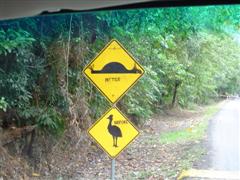
Back on the road .. passed the "Beach of the Bouncing Stones". A black
pebble beach where apparently when you walk along the beach thru' some
acoustic quirk it sounds like someone is walking behind you. A bit more
believable than the curse on the pebbles on Pebble Beach. :) Mind
you, this beach supposedly has the same curse. Passed a graffitied
Cassowary warning sign .. watch out for the cassowaries and the speed
humps ... there're more of the latter (and real suspension hazards),
built to slow down the traffic in the hope of reducing the cassowary
death toll. Curiously enuf, they're higher than those built outside
schools. Well I guess cassowaries are more endangered. For a change
this graffiti actually serves to highlight the point of the sign and
the authorities have left it as is. Passed Noah's Beach. No ark, unless
you count the park as an ark, which I guess it is. The road passed
thru' noticeably different types of rainforest as the altitude changed
... a change of as little as a few metres resulted in a totally
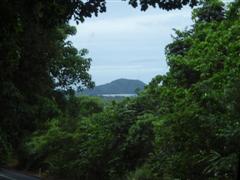
different ecology and vegetation. Atop Mt Noah there were views east
over the Great Barrier Reef and north to Cape Tribulation, the
northernmost destination on this trip. Cape Tribulation was named by
Captain Cook the morning after his ship ran aground on a reef during
the night. He wrote in his diary "Here begin my trials and
tribulations." Spying the cape the next morning, he appropriately
(given the circumstances) named it. Cook also named the mountain behind
the cape "Mount Sorrow".
|
|
|
Emmagen Beach & Cape Tribulation
Image © David Powell, 2007
|
|
|
Emmagen Beach, Cape Tribulation
Image © David Powell, 2007
|
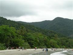
Cape Tribulation and Weary Bay. The cape is actually the peninsula
that's on the southern side of the bay. The northern peninsula, whose
name I can't find, seems to be the larger. The tour stop is actually
the bay (well the beach) rather than the Cape itself. Still, the whole
area is known as the Cape Tribulation section of the Daintree National
Park. The bay seems to be the meeting place for quite a few different
tours .. the car park was full of tour 4WDs and mini-buses. The beach
at Weary Bay is fairly sizable, tho' the sand has a grayish tinge. Cape
Tribulation forms the south arm of the beach and bay and is surrounded
by mangroves which edge onto the southern side of the beach. On the
path down to the beach from the car park there's an Umbrella Tree doing
a good imitation of a Strangler Fig .. if "good" is the right term to
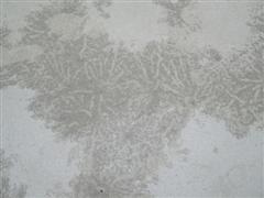
use for a strangler. All along the beach were millions of tiny balls of
sand, around 2-5mm across. The side product of tiny crabs that live in
the sand. Every low tide they have to re-excavate their burrows,
which're below the high tide level.
|
|
|
|
|
Rainforest behind Emmagen Beach,
Cape Tribulation
Image © David Powell, 2007 |
Tiny crab sandballs, Emmagen Beach,
Cape Tribulation
Image © David Powell, 2007 | Rainforest behind Emmagen Beach,
Cape Tribulation
Image © David Powell, 2007 |
|
After the beach there were a couple of unscheduled stops - not on the
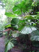
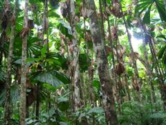
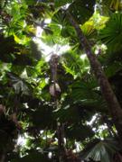
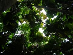
official tour, but there was some spare time. The Valley of the Palms -
a forest of tall fan palm trees. An incredible place. Totally quiet
apart from an occasional bird call and so peaceful. The palms grew to a
height of at least 20 metres and topped by a spray of fan shaped leaves
that looked and felt like plastic. The canopy was almost complete with
only a few spots where the light managed to get thru'. Beneath in the
dim coolness there was a forest of trunks and almost no undergrowth ..
very much like being in a cathedral. An amazing experience.
|
|
|
|
|
Fan Palms,
Alexandra Bay
Image © David Powell, 2007 |
Fan Palms cathedral, Alexandra Bay
Image © David Powell, 2007 | Fan Palms cathedral,
Alexandra Bay
Image © David Powell, 2007 |
Fan Palms cathedral, Alexandra Bay
Image © David Powell, 2007 |
|
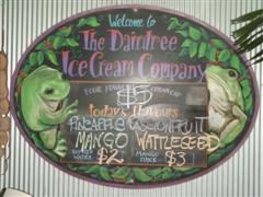
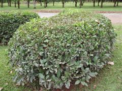
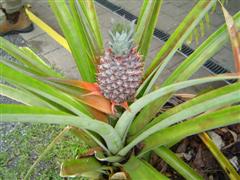
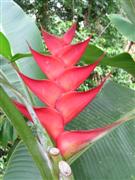
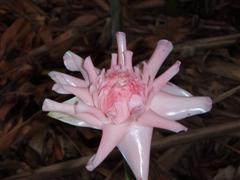
Stopped at the Daintree Icecream Company. Yes, in the middle of Cape
York an ice-cream factory. Interesting flavours .. it's a tropical
fruit orchard and they make some unusual flavoured ice-creams for
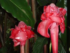
passing tourists. Beautiful gardens with some most unusual plants. The
Pitcher Plant, a carnivorous plant, was perhaps one of the more
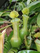
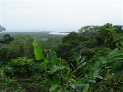
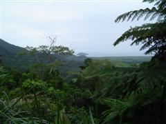
familiar plants, which gives you an idea about the rest! Next stop was Mt Alexandra Lookout. great views of the Daintree
River mouth, north to Cape Tribulation and south .. well on a good day
you can see all the way to Port Douglas. The southern view was
shrouded in rain, but you could just barely with maybe a bit of
imagination, make out the vague outline of the Port Douglas peninsula.
|
|
|
|
Daintree Ice-cream Company, Alexandra Bay
Image © David Powell, 2007 |
Tea plants, Daintree Ice-creamery
Image © David Powell, 2007 | Pineapple, Daintree Ice-creamery
Image © David Powell, 2007 |
|
|
|
|
|
Tropical flowers,
Daintree Ice-creamery
Image © David Powell, 2007 |
Tropical flowers, Daintree Ice-creamery
Image © David Powell, 2007 | Pitcher Plant,
Daintree Ice-creamery
Image © David Powell, 2007 |
Tropical flowers, Daintree Ice-creamery
Image © David Powell, 2007 |
|
|
|
|
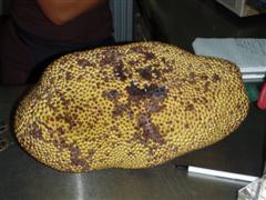
One mother of a tropical fruit!
Daintree Ice-creamery
Image © David Powell, 2007 |
View from Mount Alexandra Lookout,
Daintree National Park
Image © David Powell, 2007 | View from Mount Alexandra Lookout,
Daintree National Park
Image © David Powell, 2007 |
|
|
|
Country bar, Crossroads Cafe,
near Daintree
Image © David Powell, 2007
|
|
Crossed the Daintree River on the ferry this time. The ferry controls
the only road access to the immediate north. There is a road going to
Cooktown, some hundreds of kilometres further north, but it loops
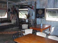
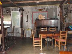
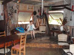
inland around the Daintree. Stopped for a pit-stop at the "Crossroads
Cafe". A little cafe and bar. Interesting decor in the bar - very
outback-cum-country style. In this case genuine, rather than the fake
varieties we saw in Cairns and Port Douglas. Pretty ramshackle ... I
suspect there's not much of a local building code. Then the long drive
back to Palm Cove. The weather was fairly obliging all day - apart from
the Bug House stops, the temperatures were in the mid 20's and only an
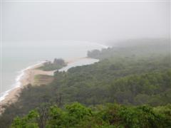
occasional and short lived sprinkle. Further south it was a different
matter ... from Cairns to Port Douglas it'd rained most of the day ..
it was lucky we headed north and missed them. Still, the area between
Cairns and Port Douglas needs the rain .. 6 months or so of the dry
season and it
Finished the day off with dinner at a US-style restaurant on Palm
Cove's esplanade, along the beachfront, complete with life-sized models
of the Blues Brothers out the front - the original ones, that is.
|
|
|
Country bar, Crossroads Cafe,
near Daintree
Image © David Powell, 2007
|
|
|
|
|
|
|
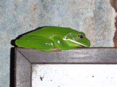
Bar mascot, Crossroads Cafe,
near Daintree (yes, it's alive)
Image © David Powell, 2007 |
Cynthia & Country bar, Crossroads Cafe,
near Daintree
Image © David Powell, 2007 | Beach & coast view in the rain,
along Captain Cook Highway
Image © David Powell, 2007 |
|
